
These are some of the capacity building workshops, trainings, seminars, talks and news articles that have occurred in the past. Trainings and workshops can be tailor-made depending upon the background of participants. Academic institutions, NGOs and community based organizations are strongly encouraged to go through these workshops.
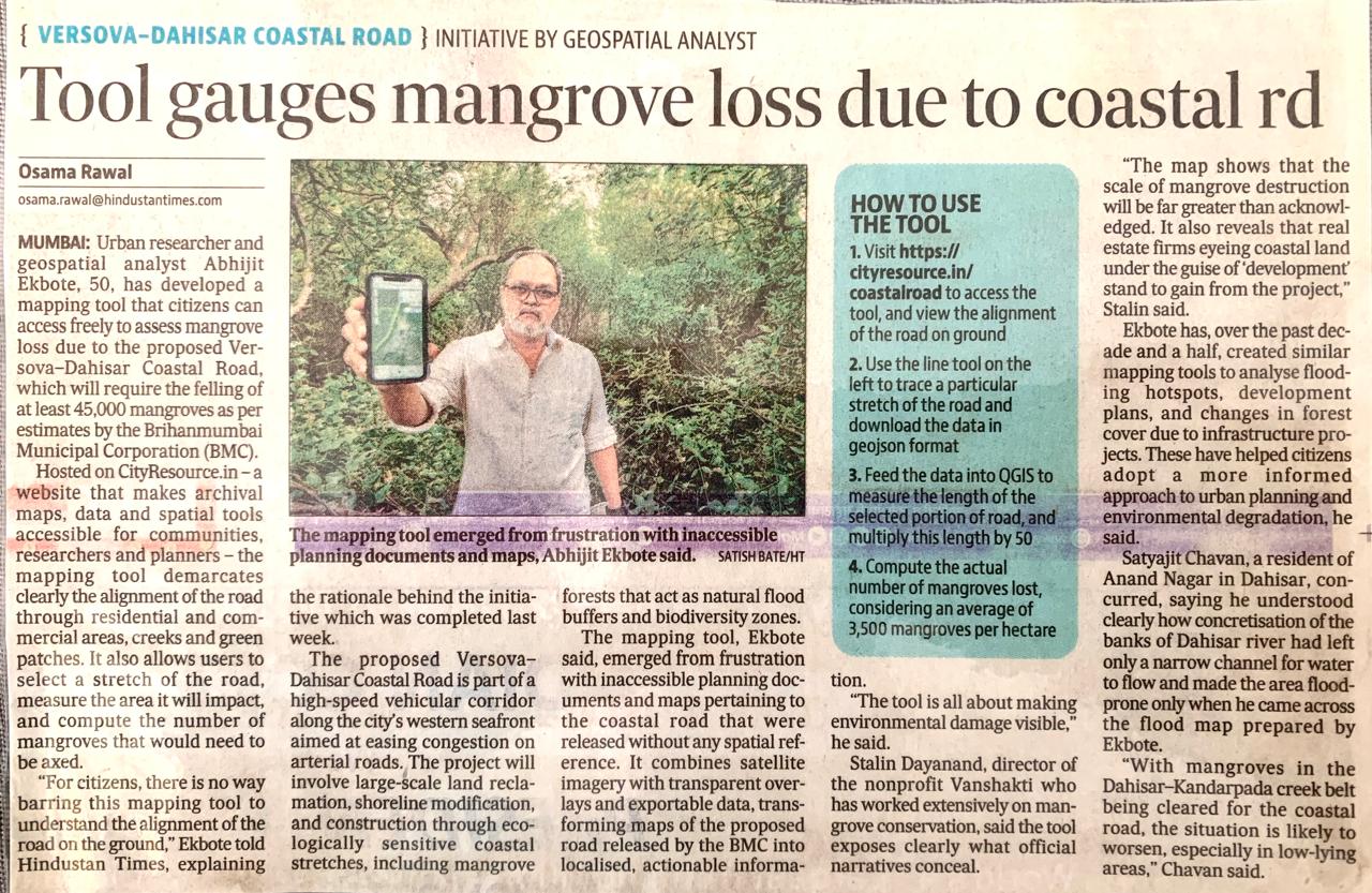
The proposed Versova–Dahisar Coastal Road is part of a high-speed vehicular corridor along the city’s western seafront aimed at easing congestion on arterial roads. The project will involve large-scale land reclamation, shoreline modification, and construction through ecologically sensitive coastal stretches, including mangrove forests that act as natural flood buffers and biodiversity zones.
The mapping tool demarcates the alignment of the road through residential and commercial areas, creeks and green patches. It also allows users to select a stretch of the road, measure the area it will impact, and compute the number of mangroves that would need to be axed.
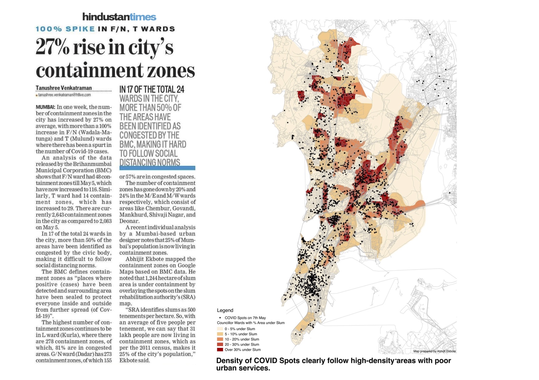
The Hindustan Times article can be accessed here
The Mumbai Live article can be accessed here
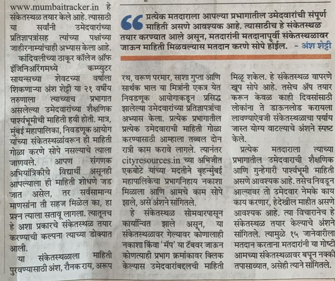
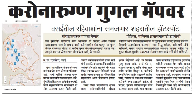
Maharashtra Times covered my initiative to create a platform where one can draw on the ward map and download geojson file. This was used by mumbaitracker.in to host candidate information.
Delighted to have given a guest talk titled ‘Mapping Water’ at KLTIWARI DEGREE COLLEGE of Architecture. It was energizing to engage with students who asked sharp, relevant questions on urban flooding. The talk explored how historical maps help us understand urban flooding in four Indian cities, Bengaluru, Delhi, Chennai, and Mumbai, each shaped by its geography and urban development. In Bengaluru, the 1935 map reveals a once-thriving network of lakes and tanks that managed rainfall and supported groundwater recharge. With the shift to piped water during colonial times, these systems were neglected, filled, and built over leading to both water scarcity and flooding today. Delhi’s 1857 map shows the Ridge and the Yamuna floodplains with ravines acting as natural drainage. But British planning after the 1857 uprising, and later the rapid urbanization that followed, replaced these systems with rigid grids of roads, compromising flood resilience. In Chennai, the 1834 map indicates a landscape of tanks and plantations. But urban sprawl and land use change have hardened the ground, leaving the city vulnerable, as seen during Cyclone Michaung in 2023. Mumbai’s 1926 map highlights marshes and low-lying areas that are now sites of chronic flooding. Reclamation for town planning and real estate development disrupted the natural drainage paths, increasing risk during high tide and extreme rainfall.
Represent Alt Surya as a Senior Consultant at Mainstreaming Climate Action in Indian Cities’ held at Chennai. C40 Cities South and West Asia has been working with the Greater Chennai Corporation on its first climate budget and with Chennai Metropolitan Development Authority on incorporating climate strategies identified in the Chennai climate action plan into the city's Third Masterplan.
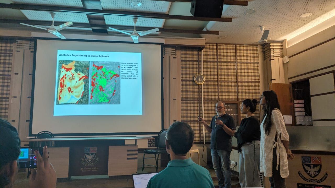
Participated in a data-jam on heat stress organized by OpenCity.in and Oorvani Foundation and supported by WRI India, C40 Cities, Citizen Matters, Climate Group, Heat Action Coalition and Blue Ribbon Movement at St. Xavier's College, Mumbai. Our team uncovered that in Mumbai’s H East ward, roads occupy 23% of the area, contributing to surface temperatures as high as 41–44°C. Shockingly, over 70% of the population lives in slums, which cover just 10% of the ward’s land area and lack any green cover, with temperatures peaking at 42–45°C.
The Draft Development Plan 2044 for Panvel was released on 8th August 2024 for suggestions and objections to be submitted till the 7th September 2024. I had put together an interactive platform in collaboration with YUVA where one can see the DP sheets with proposed reservations against a satellite image. You can draw on it to see the implications on ground, take screenshots and compile your suggestions/objections. The map QR code was displayed during the stakeholder consultation which was used by the participants.


Presented at the Tata Institute of Social Sciences (TISS) on the challenges and opportunities of using digital technology in mapping land records. I had showed a project carried out in the past where a resettled village, Saloshi, near Koyna dam was mapped using participatory methods on ground.

Gave a talk and presented at the Coomarswamy Hall at CSMVS (formerly Prince of Wales musuem) under the theme, Maps and Nature, organised by KRVIA Mumbai. My talk was about how the practise of representing nature through maps reflects the way in which extreme events are percieved and communicated.

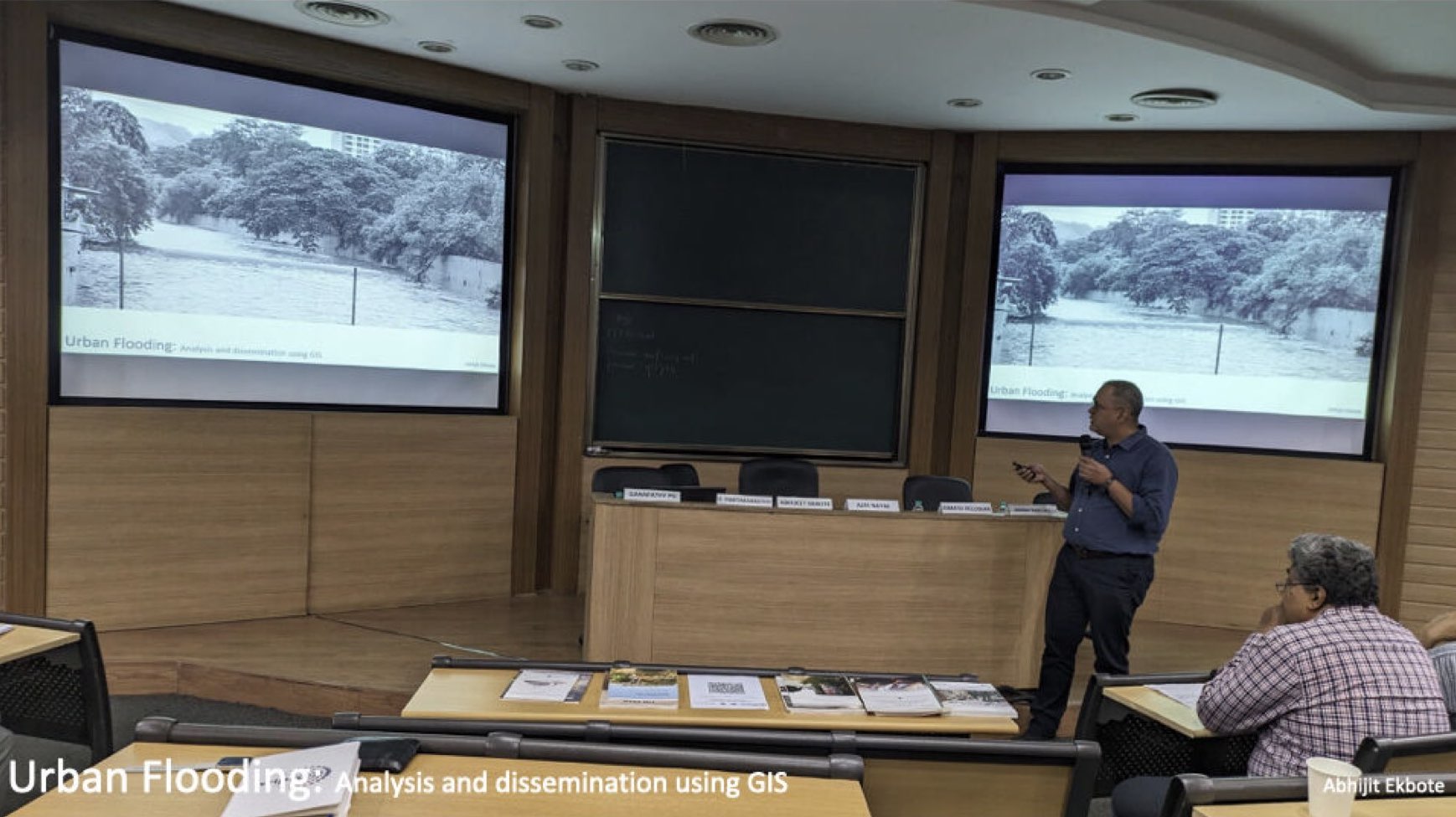
Gave a talk and presented at IIT Bombay on Urban Flooding, Analysis and Dissemination using GIS. In my talk I could share the tools and methods which can be used to explain the phenomenon of flooding in simple ways. The event was called Urban Waters Forum 2024 organised by WIPRO Foundation and the title of my panel was "Understanding Flood Management In Mumbai". Grateful to WIPRO Foundation for the opportunity.
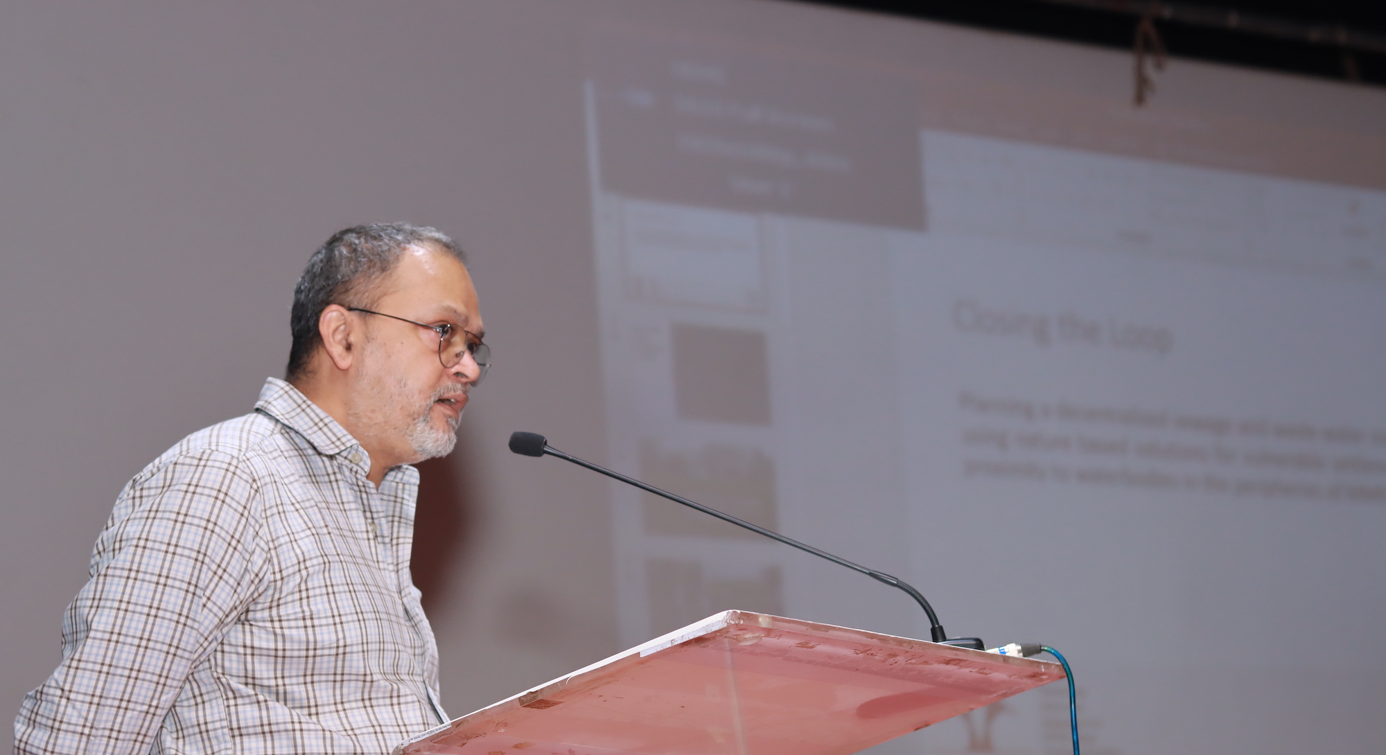
Presented SPARC's ongoing UNDP funded project 'Closing the loop' at the Indian Council of Social Science Research (ICSSR), Kalina, Mumbai. The theme of this national seminar was 'Bridging Equity and Sustainability: Inclusive Climate Action for G20 Summit Goals in India'. Our project 'Closing the loop' deals with restoration of waterbodies through treatment of wastewater and sewage using nature based solutions in the peripheries of MMR.
The focus of the workshop was to address challenges in co-creating ecological, green spaces within vulnerable neighbourhoods in Mumbai. Over a period of two-days through presentations and panel discussions on select topics and valuable insights by several experts were shared to further the joint efforts of WRI India and the BMC in implementing greening through participatory and community-led approaches. A presentation was made here to show how a GIS based participatory mapping process can lead to an interactive and dynamic dashboard on open spaces, which is publicly viewable. The proceedings of the workshop can be found here
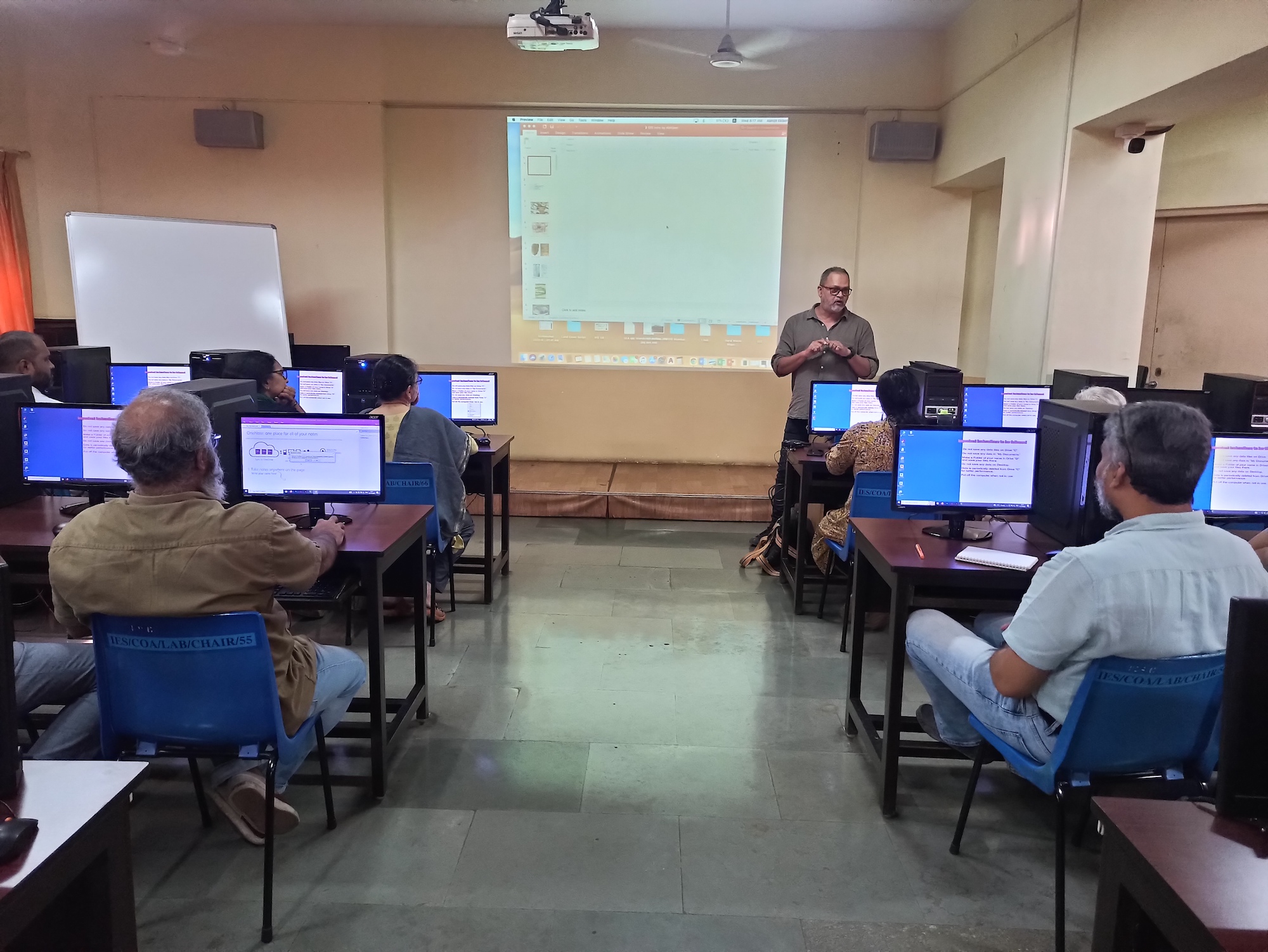
This was a 4 days GIS workshop for the faculty of IES college. Hands-on exercises were conducted on georeferencing, terrain analysis, creating vector data, designing attribute structure, joining attributes, styling and printing maps.
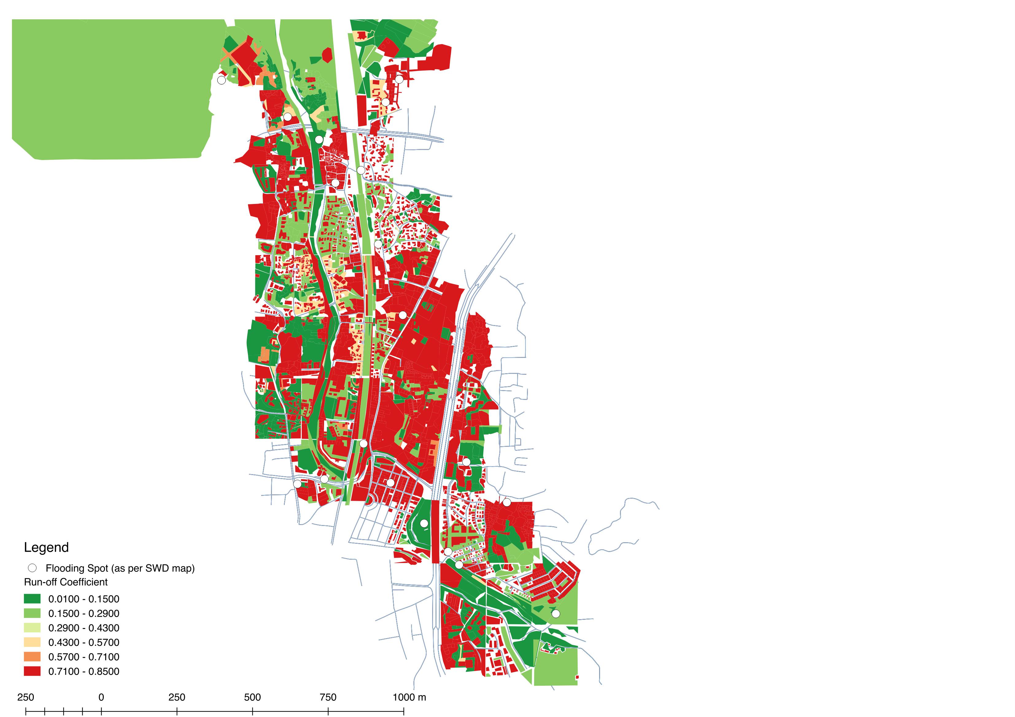
This module was conducted in collaboration with the World Resources Institute (WRI) which focussed on urban flooding as a pertinent issue. Mapping of run-off coefficients of various surfaces by ground truthing and then creating a GIS database was undertaken by the students. They subsequently highlighted key findings towards the end of the workshop.
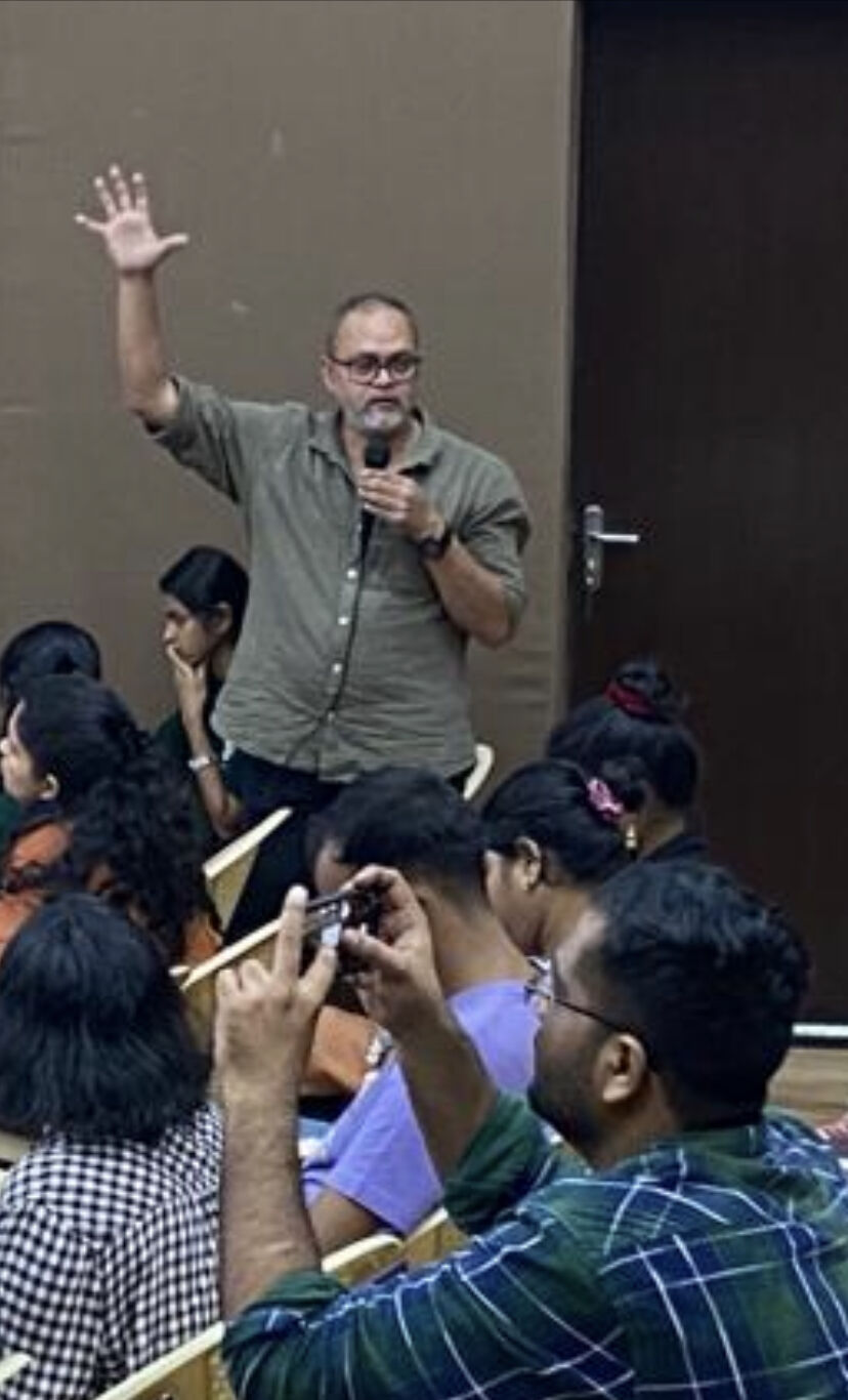
Urban planning & governance is increasingly relying on technology. Be it to extract details of land form, amenities available or geospatially map homes, livelihoods in informal settlements. GIS based mapping methods, slum census or surveys in informal settlements are technology driven – we question what has sparked this revolution, its politics, shortfalls and challenges and also bring to the discussion success stories of working with technology in informal settlements. This theme was explored in the form of presentations and a workshop where open source GIS software was introduced to participants. The GIS workshop was planned as a hands-on workshop for interested persons to know how maps are made, communicated and published. Exercises were undertaken where the volunteers from community based organisations were exposed to georeferencing and understanding the development plans of their own regions. The details of the symposium can be found here.

This work is licensed under a Creative Commons Attribution 4.0 International License