CityResource.in is a platform dedicated to making urban data, maps, and spatial tools accessible, usable, and actionable for communities, researchers, planners, and institutions. We believe that cities are better understood — and improved — when people can collaboratively map, document, and share local knowledge. Our tools allow users to visualize historical maps, draw features on modern basemaps, download spatial data in open formats like GeoJSON, and engage with the geography of their neighborhoods and regions in meaningful ways. The platform is built with openness and adaptability in mind, supporting public participation, educational use, and research on themes such as urban change, heritage, ecology, and social infrastructure. Whether you're a student exploring your city, a community organization mapping a local issue, or a planner seeking participatory inputs — CityResource.in aims to be your spatial companion.
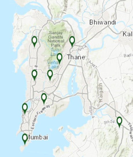
You will find maps which intend to make an argument. For instance, the 1966 Map of Mumbai (Bombay), when overlaid on the current OSM, one can see how the mud flats are built upon, with no flood mitigation plan in place. Below are some useful web maps showing Bombay's evolution. The 'Other Cities' section hosts old maps of Vasai Virar, Mira-Bhayandar, Bengaluru, Chennai, Delhi, Panvel, Chatrapati Sambhaji Nagar (Aurangabad), Nasik, Raigad District (part) and Chilka Lake in Orissa.
This platform is free to use and relies on your support to keep the servers running. If you find it useful, you can buy me a chai :)
(click on a map to view it overlaid on satellite imagery in a new window)
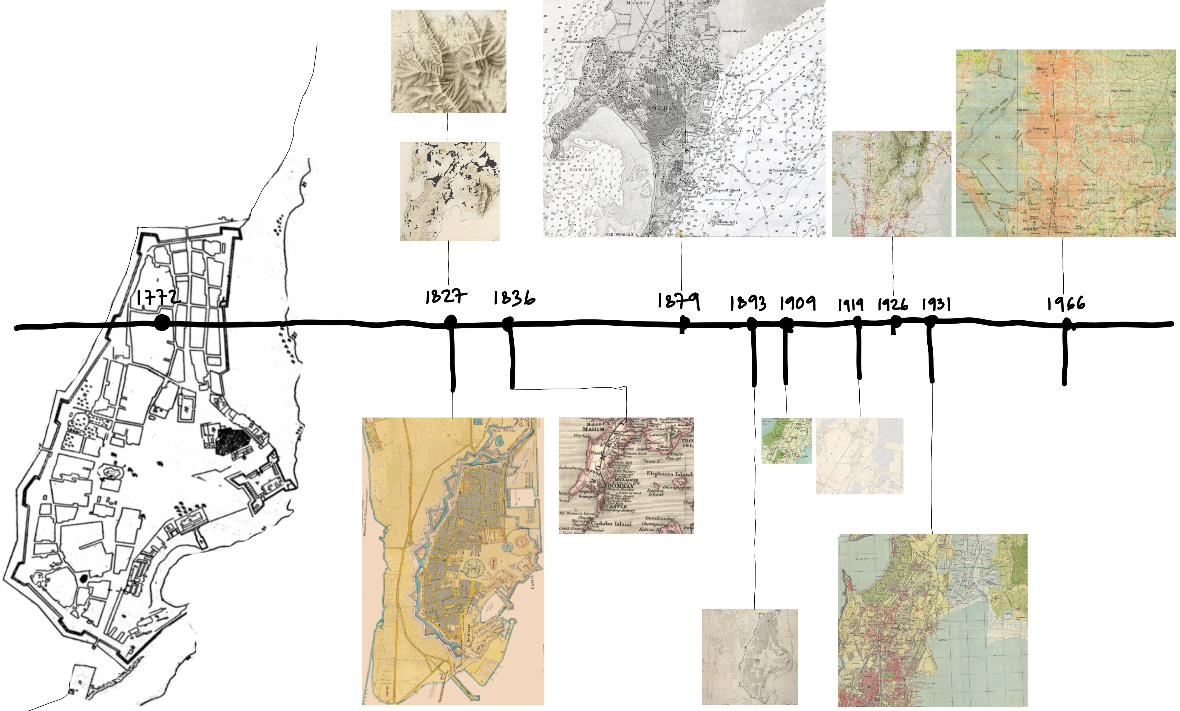
To see all historical maps as webmaps on a single page, click here
You can draw lines, points and polygons (also circles of varying diameters on the map) and write notes/names/labels for each of the features. This data can be downloaded in geoJson format from the 'download Geojson' button on the right upper corner, and can be converted to kml using online conversion tools. The kml files can then be downloaded and opened inside Google Earth Pro. This is useful while mapping collaboratively in a team.

This work is licensed under a Creative Commons Attribution 4.0 International License